
The U.S. Climate Resilience Toolkit offers Canadian farmers a powerful, data-rich platform to assess climate risks and identify soil-water management strategies, though it requires careful adaptation to work effectively north of the border. This free, government-maintained resource provides drought projections, precipitation trends, and sector-specific adaptation case studies that Alberta producers can use to make informed decisions about water conservation, soil health, and crop selection. The process takes roughly 30 to 45 minutes to navigate initially, with moderate difficulty due to the need to cross-reference U.S. climate zones with Canadian equivalents and validate data through local sources like Agriculture and Agri-Food Canada.
Why turn to an American resource? The toolkit’s strength lies in its integration of climate modeling with practical farm-scale applications, something no single Canadian platform currently matches in scope. Prairie farmers facing increasingly unpredictable rainfall patterns and extended dry periods have found value in the toolkit’s drought early warning systems and soil moisture monitoring frameworks, then worked with provincial agronomists to calibrate the insights for Alberta conditions.
The key is treating the toolkit as a starting point rather than a final answer. You’ll pull relevant climate projections and resilience strategies from the platform, then ground-truth them against local soil types, weather station data, and the experiences of producers in your region. This introduction walks you through accessing the toolkit, interpreting its data for Canadian contexts, implementing soil-water practices based on your findings, and verifying results through on-farm monitoring.
What You’ll Need to Get Started
Before you start using the U.S. Climate Resilience Toolkit to improve your soil-water management, gather a few essential pieces of information about your farm and ensure you have access to the necessary digital resources. The good news is that most of what you need is either freely available online or already in your farm records.
You’ll need the following to make the most of the toolkit:
- A computer or tablet with internet access to navigate the toolkit website at
- Your farm’s GPS coordinates or postal code to identify comparable climate regions
- Basic soil information including soil type, texture, and drainage class (available from provincial soil surveys or your local agrologist)
- Knowledge of your primary water sources: dugouts, wells, irrigation systems, or surface water
- Historical yield records from the past 5-10 years, if available, to identify weather-related patterns
- Information about your current crop rotation and any existing conservation practices
Start by locating your soil type using Alberta’s online soil maps or your farm’s existing soil test results. Knowing whether you’re working with heavy clay, loam, or sandy soils will help you evaluate which toolkit recommendations are most relevant to your conditions. If you’ve never had a formal soil test done, consider getting one through your local agricultural fieldman or a private lab before diving into the toolkit.
For water sources, document what you currently rely on and any challenges you’ve experienced during drought years or heavy rainfall periods. This baseline understanding will help you identify which climate resilience practices address your specific vulnerabilities. Keep a notebook or digital file to track the information you find, as you’ll reference it throughout the implementation process.
Important Considerations Before You Begin
The U.S. Climate Resilience Toolkit provides valuable climate projections and management strategies, but it was built with American agricultural regions in mind. Alberta’s prairie climate, shorter growing season, and different precipitation patterns mean you cannot simply copy-paste U.S. recommendations without adjustment. The toolkit’s data often reflects conditions in states like Montana or North Dakota, which share some similarities with southern Alberta but differ in soil classification systems, frost dates, and winter severity.
You will need to convert U.S. measurements to metric and cross-reference climate projections with data from Environment and Climate Change Canada or Alberta Agriculture for your specific region. The toolkit may suggest practices tested in USDA climate zones that do not directly translate to Canadian Plant Hardiness Zones. Pay particular attention to timing recommendations, as Alberta’s compressed growing window affects when you can work soil, plant cover crops, or install water management infrastructure.
Recognize when you need professional assessment rather than self-guided implementation. If your land has drainage issues, significant slope variation, or history of erosion, a certified agrologist should evaluate soil structure and water flow patterns before you commit resources. Complex practices like installing tile drainage, building retention ponds, or altering field topography require engineering expertise and often permits. Start with simpler observational work and pilot projects to test how toolkit concepts perform on your actual ground.
Step-by-Step: Navigating the Toolkit for Soil-Water Solutions
Explore Climate Projections for Your Region
Start by accessing the Climate Explorer tool on the U.S. Climate Resilience Toolkit homepage. Since the toolkit uses U.S. geography, you’ll need to locate regions climatically similar to your Alberta location, northern Montana, North Dakota, and Saskatchewan’s border areas often share comparable precipitation and temperature patterns with southern Alberta’s prairie zones.
Focus on three key climate variables that directly affect soil-water management. First, examine precipitation projections, particularly seasonal distribution changes. Alberta farmers should look for increases in winter precipitation (which may arrive as rain rather than snow) and potential spring drought intensification. The toolkit’s drought monitor helps identify multi-year dry periods that stress soil moisture reserves.
Second, review extreme weather projections, especially intense rainfall events. Even if annual precipitation stays constant, concentrated downpours increase runoff and erosion while reducing infiltration, critical considerations for drainage planning and cover crop timing.
Third, compare the toolkit’s U.S. data against Canada’s changing climate projections for the prairies to validate patterns. Canadian data consistently shows warming trends and shifting precipitation, often 10-15% increases in annual moisture but concentrated in fewer, heavier events.
Download the relevant datasets as CSV files for your baseline analysis. Note the toolkit uses Fahrenheit and inches; convert these to Celsius and millimeters immediately. This climate foundation informs which soil-water practices will address your specific risks, whether that’s managing excess spring moisture or building drought resilience through the growing season.
Identify Soil-Water Practice Solutions
Once you’ve identified your climate risks, navigate to the toolkit’s Steps to Resilience section and browse the Case Studies database. Filter by topics like “Agriculture,” “Water,” and “Soil Health” to find practices proven in climates facing similar challenges, extended dry spells, intense rainfall events, or shifting frost dates. The toolkit doesn’t hand you a prescriptive list, but its real-world examples show what worked for other farmers dealing with comparable conditions.
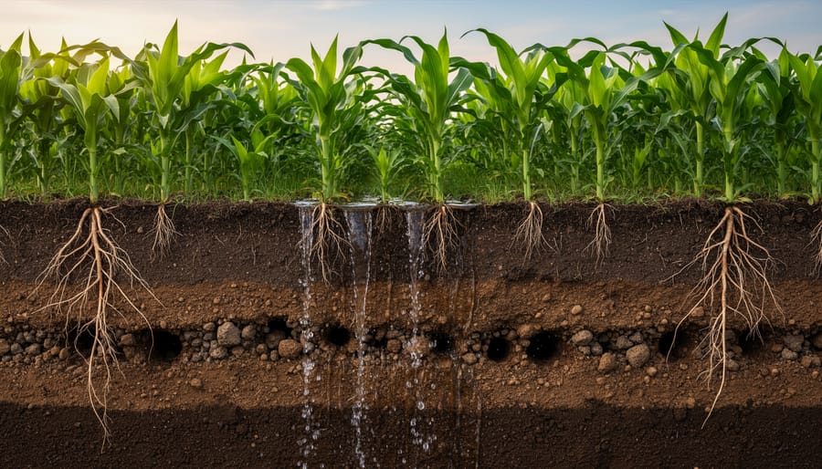
Look for soil-water practices that match your primary risks. If drought is your concern, search case studies featuring cover cropping and conservation tillage. Cover crops increase infiltration and build organic matter, improving your soil’s ability to capture and hold moisture during dry stretches. For fields prone to waterlogging or erosion from heavy rains, look for examples of drainage management, grassed waterways, or retention ponds that slow runoff and protect topsoil.
Pay attention to the scale and context in each case study. A 2,000-acre Kansas wheat operation’s approach to residue management might translate well to southern Alberta, while a Vermont vegetable farm’s water retention structures could inform smaller diversified operations. Note the metrics farmers tracked, soil moisture retention percentages, reduced irrigation needs, or tonnes of topsoil saved, so you can gauge whether a practice justifies the investment on your land.
Bookmark three to five relevant case studies that address your top climate risks. You’ll use these as templates when adapting practices to your specific soil type and equipment in the next step.
Assess Practices Against Your Farm Conditions
Once you’ve identified promising soil-water practices from the toolkit, match them against your actual field conditions rather than adopting recommendations wholesale. Start by checking your soil texture, the toolkit’s sandy loam suggestions won’t perform identically on Alberta’s heavy clay soils common in the Peace Country or Black soil zones. Pull your soil test results and note drainage capacity, organic matter percentage, and any identified limitations like salinity or shallow hardpan layers.
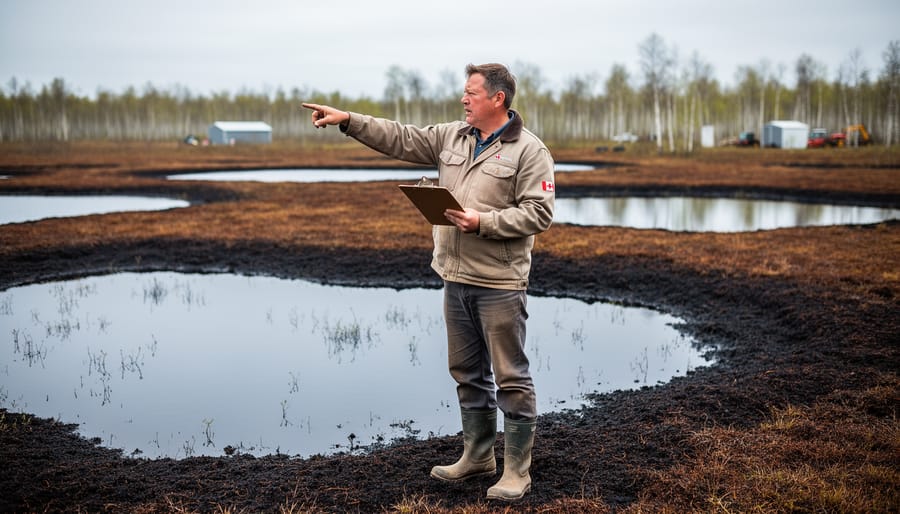
Evaluate slope and topography next. A practice designed for flat Midwest cropland needs modification on rolling parkland terrain. Fields with more than 2-3% slope require different erosion controls and water management structures than level ground. Walk your fields after heavy rain to spot where water pools, channels, or runs off, these observations matter more than generic recommendations.
Review your existing infrastructure critically. Installing the toolkit’s suggested contour buffer strips works only if you have equipment that can navigate curved rows, and adding drainage tiles makes sense only where you can legally discharge water and have suitable outlets. Consider your crop rotation too: cover crop recommendations assuming corn-soybean systems need adjustment for Alberta’s wheat-canola-pulse rotations and shorter growing season.
Convert all measurements immediately, transform inches of rainfall to millimetres, acres to hectares, and Fahrenheit thresholds to Celsius to avoid costly field errors. Cross-reference practices against your water sources; a strategy requiring supplemental irrigation fails farms relying solely on precipitation.
Test one practice on a small area first. If the toolkit suggests water infiltration improvements through reduced tillage, pilot it on 10-20 acres before committing whole fields. Similarly, apply targeted compaction fixes to problem zones rather than uniform treatment. Document what works in your specific conditions, then scale accordingly.
Create Your Implementation Timeline
Turn your selected soil-water practices into a realistic timeline by breaking implementation into manageable phases. Start small rather than overhauling your entire operation at once.
Choose a pilot area of 10-20 acres where you can test practices like cover cropping or retention berms without disrupting your main production. Pick a field that represents your farm’s typical conditions but isn’t your highest-value crop land, this gives you room to learn and adjust.
Map your implementation around Alberta’s growing season. If you’re introducing cover crops, plan seeding for late August through September after harvest. Conservation tillage adjustments need to happen before spring seeding (April, May), while water retention structures should be installed during dry periods in summer or early fall when soil isn’t saturated.
Phase your timeline across two to three years. Year one focuses on your pilot area and gathering baseline data on soil moisture and infiltration. Year two expands successful practices to 25-30% of your operation while refining techniques. Year three scales to broader acreage based on proven results.
Block out time for the work itself, cover crop seeding might take two days, installing grassed waterways requires a week with equipment, and adjusting tillage practices happens gradually during regular field prep. Factor in weather delays and avoid scheduling conflicts with harvest or calving season.
Document costs, labour hours, and observations at each phase. This record proves invaluable when deciding whether to expand, modify, or redirect your approach based on what actually works in your fields.
Testing Results and Measuring Success
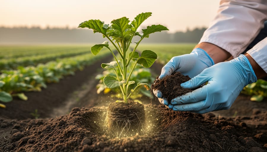
Knowing whether your soil-water practices are making a real difference requires setting clear baselines before implementation and tracking specific metrics over time. Start by documenting your current conditions: take soil samples to measure organic matter percentage, bulk density, and aggregate stability in the areas where you’ll be implementing practices. Establish your baseline water infiltration rate using a simple ring infiltrometer test, and photograph or map areas prone to ponding, runoff, or erosion.
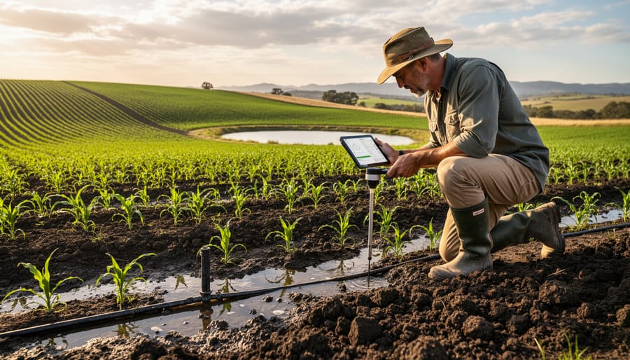
Once practices are in place, monitor soil moisture retention by checking depths at consistent intervals following rain events. A soil probe lets you see how deeply water is penetrating compared to your baseline. After heavy rainfall, walk your fields to observe where water now infiltrates versus where it previously pooled or ran off. Many Alberta farmers find that cover crops or reduced tillage show measurable improvements in moisture retention within one growing season, particularly in lighter soils.
For water infiltration, repeat your ring infiltrometer test annually in the same locations. You should see infiltration rates increase as soil structure improves. Document erosion changes by taking photos from fixed points each spring and fall, comparing gully depth, sediment accumulation in low spots, and soil loss around field edges. Advanced options include satellite monitoring to track vegetation health and moisture patterns across larger areas, though ground-truthing with your own observations remains essential.
Set realistic expectations: most soil-water practices show measurable improvement within two years, but significant structural changes to degraded soils may take three to five seasons. If monitoring reveals plateaued results or unexpected challenges, adjust your approach rather than abandoning the practice entirely.
Real-World Application: Alberta Farmer Perspectives
We spoke with Jake Morrison, a grain farmer near Lethbridge, who turned to climate projection data similar to what the U.S. toolkit provides after three consecutive years of spring drought threatened his seeding windows.
“I wasn’t looking at fancy American tools at first,” Morrison admits. “But when our local extension office mentioned using cross-border climate data to understand precipitation trends, I figured any information was better than guessing.” He started with projected rainfall patterns for Montana and North Dakota, regions with comparable semi-arid conditions to southern Alberta, then cross-referenced them with Environment Canada data.
The projections showed increasingly erratic spring moisture, which pushed Morrison to install water retention ponds and switch 40% of his operation to no-till with diverse cover crops. “Within two growing seasons, I could seed a week earlier because my soil held moisture longer. We’re talking measurable differences, soil probes showed 15-20% better water retention at 15 centimetres depth compared to my neighbour’s conventional tilled fields.”
Sarah Chen, an agronomist working with mixed farms in the parkland region near Westlock, emphasizes the adaptation process. “Farmers can’t just copy-paste American case studies. A Texas cover crop mix won’t survive our winters.” She guides clients to extract the principles, like using multi-species covers to improve water infiltration, then substitute cold-hardy species suited to Alberta’s Zone 3 climate.
Chen’s clients track results through simple soil penetrometer tests and spring runoff observations. “One cattle operation reduced spring runoff by roughly one-third after two years of adaptive grazing patterns informed by drought-risk data. That’s water staying on their land instead of racing to the ditch.”
Common Questions About Using Climate Tools for Soil-Water Management
Farmers exploring climate resilience tools often have similar questions about adapting U.S. resources for Canadian farms. Here are the most common concerns we hear from Alberta producers getting started with climate-informed soil-water management.
Is the U.S. Climate Resilience Toolkit free to access from Canada?
Yes, the toolkit is completely free and accessible online from anywhere, including Canada. There are no registration fees, subscription costs, or geographic restrictions for viewing climate projections, case studies, and practice recommendations.
How do I convert U.S. climate data to work for my Alberta farm?
Focus on climate zones and precipitation patterns rather than specific state boundaries. Look for U.S. regions with similar growing degree days and rainfall patterns to your area, then cross-reference findings with Environment and Climate Change Canada data to validate trends. Most Alberta farms align climatically with northern Montana or North Dakota border regions.
Can I combine this toolkit with Canadian agricultural programs?
Absolutely. The toolkit’s recommendations complement programs like the Canadian Agricultural Partnership’s Environmental Stewardship and Climate Change initiative. Use the toolkit for climate projection insights and practice ideas, then apply through provincial programs for implementation funding and technical support from local agronomists.
What if the recommended practices don’t match my soil type?
Treat toolkit recommendations as starting points, not rigid prescriptions. Always verify practices with a local agronomist who understands your specific soil classification, drainage characteristics, and regional climate nuances before making significant changes to your soil-water management approach.
Beyond these basics, many farmers wonder about the time commitment required. Realistically, your initial exploration of the toolkit takes two to three hours to identify relevant climate projections and potential practices. From there, consulting with local experts and planning your first pilot implementation adds another few weeks, but this upfront investment pays dividends in long-term farm resilience.
The key is not to feel overwhelmed by the breadth of information available. Start with one specific challenge you’re facing, whether that’s spring flooding, summer drought stress, or soil erosion on a particular field. Use the toolkit to understand how climate trends might intensify that issue, identify two or three proven practices that address it, then discuss feasibility with your agronomist. This focused approach makes climate adaptation manageable rather than paralyzing.
The U.S. Climate Resilience Toolkit proves that valuable climate adaptation knowledge crosses borders easily. While the data originates south of the 49th parallel, the soil-water challenges Alberta farmers face mirror those in similar prairie ecosystems. You now have a clear pathway to translate this American resource into practical action on Canadian ground.
Start with one practice that addresses your most pressing concern, whether that’s spring runoff management or summer drought resilience. Test it on a small portion of your land before scaling up. The economic benefits of improved water retention and reduced erosion compound over seasons, building both soil health and farm profitability.
You’re not working in isolation. Connect with provincial agrologists through Alberta Agriculture and Irrigation, tap into Growing Forward funding programs that support climate adaptation, and join local soil health networks where farmers share real-world results. The University of Alberta’s Agricultural, Life and Environmental Sciences faculty offers region-specific research that complements what you’ve learned from the toolkit.
Climate resilience isn’t built overnight, but every step toward better soil-water management strengthens your operation against whatever weather comes next. Your farm, your community, and the land itself become more adaptable with each practice you implement.