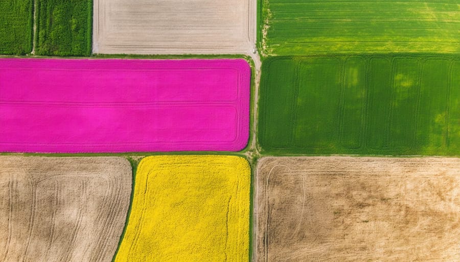
Integrate buffer zones between cropland and freshwater ecosystems in agriculture by planting native grasses and shrubs along waterways, creating vital corridors for wildlife while preventing soil erosion. Map your property’s natural water flow patterns during spring melt, identifying key drainage points and potential wetland restoration sites that can double as natural flood control systems. Establish rotational grazing patterns that allow livestock to benefit from both upland pastures and managed riparian areas, maintaining optimal grass height of 10-15 centimetres to protect soil structure. Monitor water quality monthly through simple pH and sediment tests, adjusting farming practices based on results to maintain healthy aquatic systems that support beneficial insects and natural pest control. These interconnected ecosystems, when properly managed, create a resilient agricultural landscape capable of withstanding Alberta’s extreme weather patterns while supporting sustainable crop and livestock production.
Understanding Your Farm’s Ecosystem Network
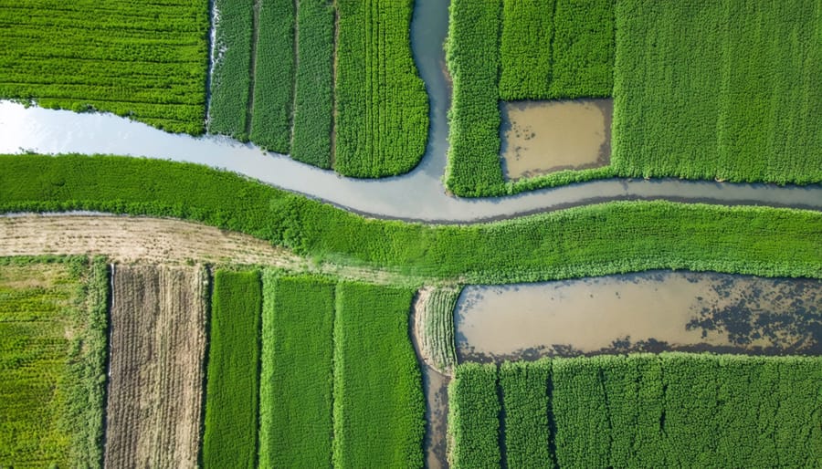
Mapping Water Flow on Your Property
Understanding water flow patterns on your property is crucial for maintaining healthy ecosystems and managing your farm effectively. Start by walking your land during both dry and wet conditions, noting where water naturally pools, flows, or drains. Pay special attention after heavy rainfall or spring melt – these events reveal important drainage patterns.
Create a simple property map marking key water features like streams, wetlands, and seasonal runoff paths. Include elevation changes, which influence water movement. In Alberta’s varied landscape, even subtle slopes can significantly impact water distribution.
Consider installing monitoring stakes at key points to track water levels throughout the year. These can be as simple as marked wooden posts that help you observe seasonal changes. For precision, use GPS coordinates to mark these locations for future reference.
Look for signs of erosion, which often indicate areas of concentrated water flow. Natural vegetation patterns can also help identify water movement – cattails and sedges typically grow where moisture is consistently present.
Remember to document your observations seasonally. This information becomes invaluable when planning infrastructure improvements or implementing water management strategies for your farm.
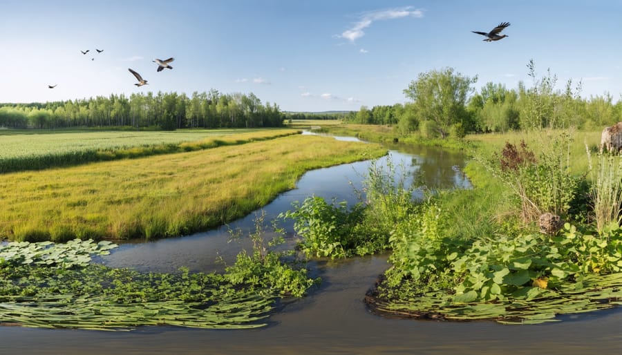
Critical Transition Zones
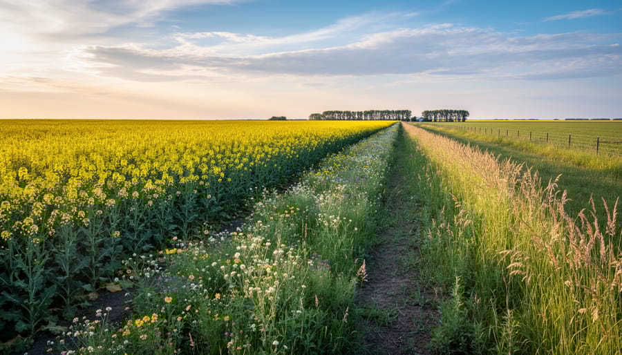
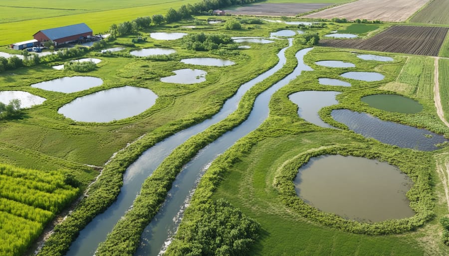
The meeting point between land and water systems creates vital transition zones that play a crucial role in Alberta’s agricultural landscape. These areas, particularly riparian buffer zones, act as natural filters and wildlife corridors essential for maintaining healthy farm ecosystems.
In southern Alberta, where water conservation is particularly important, these transition zones help regulate water flow, prevent soil erosion, and maintain water quality. Local farmers have observed that well-maintained wetland boundaries can reduce flooding during spring runoff while providing reliable water sources during drier periods.
These areas also serve as natural habitats for beneficial insects and birds that help control pest populations on nearby cropland. Many Alberta farmers have found success in preserving these zones by maintaining native vegetation and implementing managed grazing practices that protect sensitive shorelines and wetland edges.
For optimal results, experts recommend maintaining a minimum 10-metre buffer of permanent vegetation along waterways and around wetland areas. This approach has proven effective in balancing agricultural productivity with environmental stewardship across the province.
Building Resilient Farm Ponds
Strategic Pond Placement
In Alberta’s diverse landscape, strategic pond placement can make the difference between a thriving ecosystem and a struggling one. The key is to work with the natural contours of your land while considering our unique climate patterns.
For optimal pond placement, look for natural depressions or low-lying areas that already collect water during spring runoff. These locations typically require less excavation and naturally support water retention. Consider positioning your pond where it can capture both surface runoff and groundwater seepage, ensuring a more stable water level throughout our dry prairie summers.
Distance from buildings and infrastructure is crucial – maintain at least 30 metres from structures to prevent potential seepage issues. In our climate, positioning the pond where it’s partially sheltered from prevailing winds can reduce water loss through evaporation, particularly during hot summer months.
Soil composition plays a vital role too. Clay-rich soils, common in central Alberta, naturally hold water better than sandy soils. If your soil is sandy, you may need to incorporate clay liners or other sealing methods to prevent excessive seepage.
Remember to account for seasonal changes. Position your pond where it won’t be overwhelmed by spring snowmelt but can still capture enough moisture to maintain healthy water levels through summer. Consider creating shallow areas along the north edge to prevent excessive ice buildup during our harsh winters while providing essential habitat for local wildlife.
Native Species Selection
When selecting species for your integrated ecosystem, prioritizing local varieties ensures better adaptation and sustainability. In Alberta’s agricultural landscape, native aquatic plants like cattails, water sedge, and marsh marigold play crucial roles in maintaining water quality and supporting beneficial insects.
For terrestrial areas, consider incorporating white spruce, trembling aspen, and native prairie grasses like blue grama and rough fescue. These species provide natural windbreaks and habitat for beneficial wildlife while requiring minimal maintenance due to their natural adaptation to our climate.
In dugouts and farm ponds, submerged plants such as common waterweed and Richardson’s pondweed help oxygenate water and provide shelter for beneficial aquatic organisms. Adding native minnows and freshwater mussels can naturally manage algae growth and improve water clarity.
For shoreline stabilization, plant rushes and willows, which develop extensive root systems that prevent erosion. These species also create valuable transition zones between water and land, supporting diverse wildlife including pollinators and beneficial predatory insects that help control agricultural pests.
Remember to source your plants from local nurseries specializing in native species, and always check municipal regulations regarding aquatic plant introduction. Consider connecting with local conservation groups for guidance on species selection and establishment techniques.
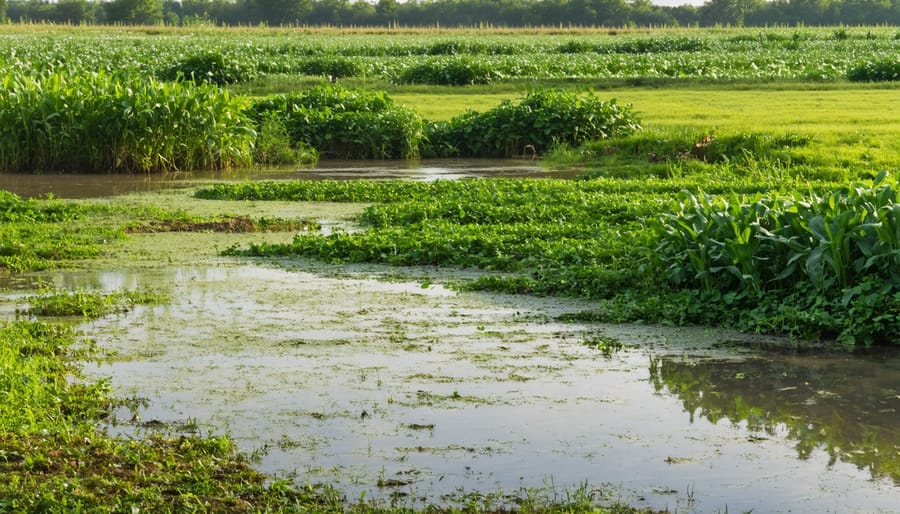
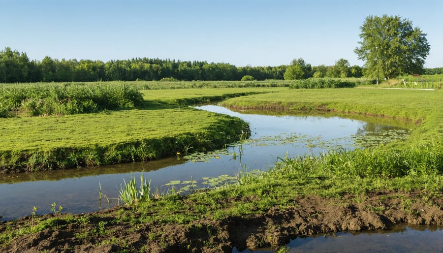
Soil-Water Management Practices
Buffer Strips and Filter Zones
Buffer strips and filter zones are essential features that help bridge the gap between agricultural land and natural water bodies. These vegetated areas act as natural filters, protecting both terrestrial and aquatic ecosystems while enhancing farm productivity. In Alberta, many farmers have successfully implemented these protective barriers, typically ranging from 5 to 30 metres wide, depending on the landscape and water flow patterns.
Native grasses, shrubs, and trees planted in these zones work together to slow water runoff, trap sediments, and filter out excess nutrients before they reach waterways. For example, the Miller family farm near Red Deer maintains a 15-metre buffer zone along their creek, using a mix of native prairie grasses and willows that effectively reduces soil erosion while providing habitat for local wildlife.
When establishing buffer strips, consider incorporating multiple vegetation layers. Start with deep-rooted grasses like blue grama and wheat grass near the field edge, then add shrubs like snowberry and red-osier dogwood, followed by trees such as Manitoba maple or white spruce closer to the water body. This multi-tiered approach maximizes filtration effectiveness and creates diverse wildlife corridors.
Maintaining these zones requires minimal effort once established. Annual inspections during spring runoff and after major storms help identify areas needing attention. Remember that healthy buffer strips not only protect water quality but can also serve as valuable shelter belts and natural snow fences during Alberta’s harsh winters.
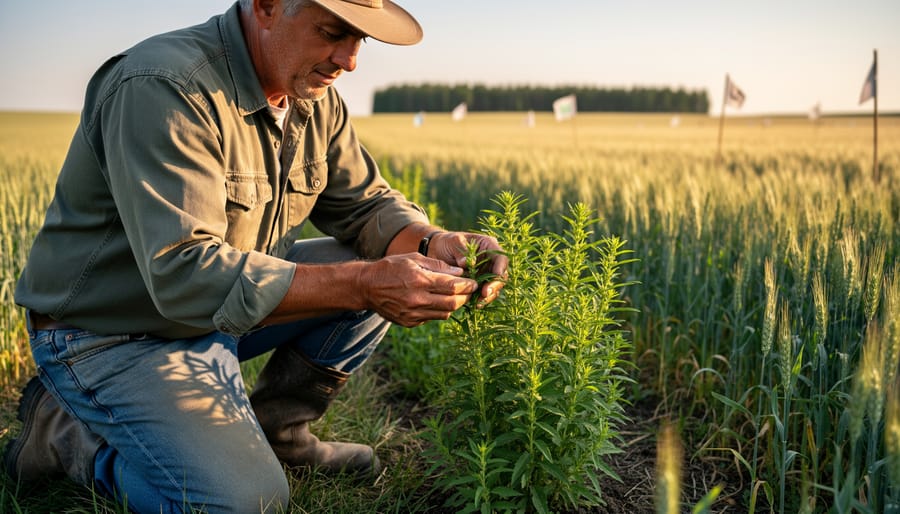
Erosion Control Strategies
Protecting our soil and water resources is crucial for maintaining healthy ecosystems on Canadian farms. Here in Alberta, we’ve seen great success with combined approaches to erosion control that work for both land and water systems.
Cover cropping has proven particularly effective, with many local farmers reporting significant reductions in soil loss. Spring wheat, winter rye, and clover are popular choices that protect soil during our challenging Prairie winters. These plants’ root systems help hold soil in place while improving its structure and organic matter content.
Buffer strips and riparian zones play a dual role in erosion control. By maintaining natural vegetation along waterways, we create barriers that slow water flow and trap sediment before it enters streams or wetlands. Many Alberta farmers have found success with native grasses and shrubs that are well-adapted to our climate.
Contour farming and strip cropping work well on sloped terrain, helping to reduce water runoff velocity. Several farms near Red Deer have implemented these techniques, reducing soil loss by up to 50% during heavy rainfall events.
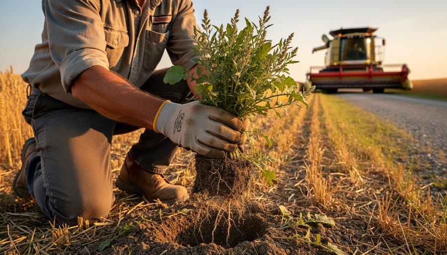
Conservation tillage practices, especially no-till farming, have become increasingly popular across the province. This approach maintains crop residue on the soil surface, protecting it from both wind and water erosion while supporting beneficial soil organisms.
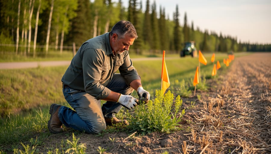
Remember to regularly monitor your erosion control measures and adjust them based on seasonal changes and weather patterns. Local agricultural extension offices can provide specific guidance for your area’s conditions.
Success Stories from Alberta Farms
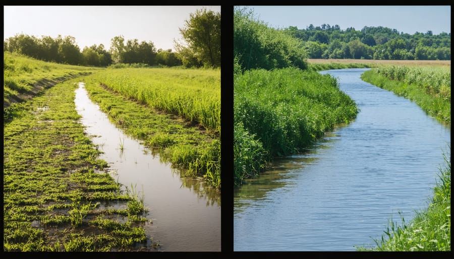
The Miller Family’s Wetland Revival
Located just outside of Red Deer, Alberta, the Miller family farm has become a shining example of successful wetland restoration techniques in action. When Sarah and James Miller inherited their 400-hectare farm in 2015, they faced a challenging decision about a drained wetland that had been converted to cropland in the 1970s.
After consulting with Ducks Unlimited Canada and local conservation experts, the Millers embarked on a three-year restoration project. They began by mapping historical water patterns and identifying native plant species that once thrived in the area. Using careful earth-moving techniques and strategic berming, they recreated the natural topography that would support water retention.
The results have been remarkable. Within two years, the restored 5-hectare wetland began attracting diverse wildlife, including northern pintails, blue-winged teal, and various amphibian species. The surrounding soil health improved significantly, with organic matter increasing from 2% to 4.5%. The Millers also noticed reduced flooding in their lower fields during spring runoff.
“The wetland actually helps our overall farm operation,” explains Sarah Miller. “It acts as a natural water filter and provides irrigation during dry spells. We’ve even seen better pollination in our canola fields thanks to the increased insect diversity.”
The Millers now host regular farm tours, sharing their experience with neighbouring farmers. Their project has inspired five other local families to undertake similar restoration work, creating a growing network of healthy wetland ecosystems across central Alberta.
Red Deer Valley Watershed Initiative
The Red Deer Valley Watershed Initiative stands as a shining example of how Alberta’s farming communities are taking the lead in protecting both land and water resources. This community-driven project, launched in 2015, brings together more than 200 local farmers, ranchers, and agricultural professionals who recognize the interconnected nature of terrestrial and aquatic ecosystems.
At its core, the initiative focuses on implementing buffer zones along waterways, managing livestock access to streams, and maintaining natural vegetation corridors. Participating farmers have reported a 30% reduction in soil erosion and improved water quality measurements across the watershed since the program’s inception.
Local farmer Sarah Thompson, who manages a 600-hectare mixed operation near Innisfail, shares her experience: “By working together with our neighbours, we’ve seen remarkable improvements in both our soil health and water quality. The initiative has helped us understand how our farming practices upstream affect everyone downstream.”
The program provides practical support through workshops, one-on-one consultations, and cost-sharing opportunities for implementing sustainable practices. Key achievements include the restoration of 45 kilometres of riparian areas, the installation of off-stream watering systems on 75 farms, and the establishment of rotational grazing practices that benefit both livestock and wildlife.
What makes this initiative particularly successful is its bottom-up approach, where local knowledge and scientific expertise come together to create solutions that work for both the environment and farm operations. Regular monitoring shows increasing populations of native fish species and the return of previously rare wildlife, demonstrating the positive impact of integrated ecosystem management.
As we’ve explored throughout this article, the successful integration of terrestrial and aquatic ecosystems on your farm can create a more resilient and productive agricultural system. By implementing buffer zones, maintaining wetlands, and practicing sustainable soil management, you’re not just protecting the environment – you’re investing in your farm’s long-term success.
Remember that you’re not alone in this journey. Alberta’s agricultural community has a strong network of support, including local extension services, conservation authorities, and experienced farmers who have already implemented these practices. The success stories we’ve shared from farms across the province demonstrate that balancing production with ecosystem preservation is both achievable and rewarding.
Start small by assessing your current land use and identifying areas where you can enhance connectivity between terrestrial and aquatic elements. Consider joining local watershed stewardship groups or participating in environmental farm plan workshops to continue building your knowledge and skills.
Looking ahead, climate-resilient farming will increasingly depend on our ability to work with natural systems rather than against them. By taking steps now to protect and enhance both terrestrial and aquatic ecosystems on your land, you’re positioning your farm for future success while contributing to Alberta’s agricultural heritage of environmental stewardship.
Take advantage of available resources and funding programs through provincial agricultural services to support your transition to more integrated ecosystem management. Your efforts today will help ensure a sustainable and productive future for Alberta’s agricultural landscape.