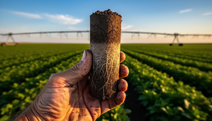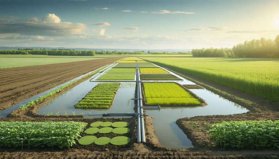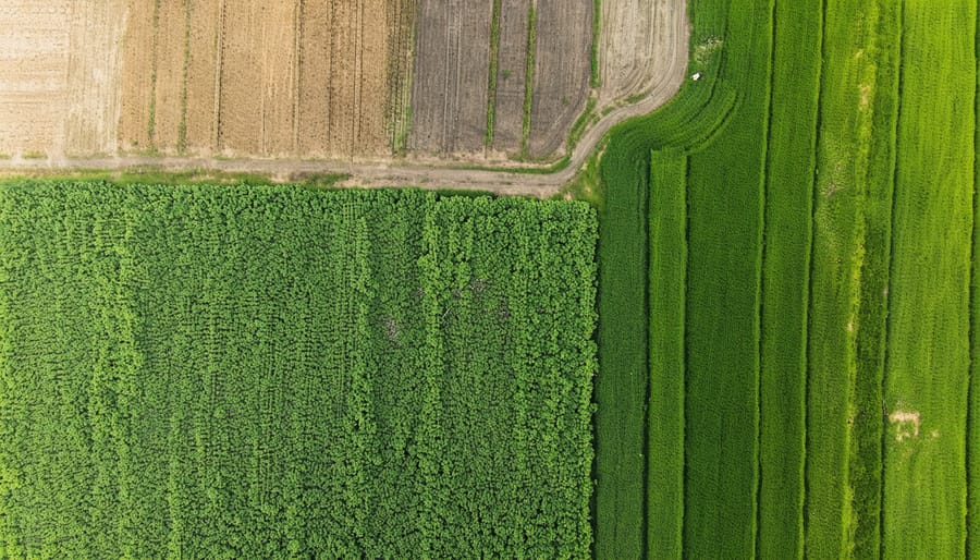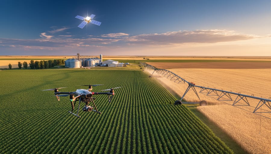
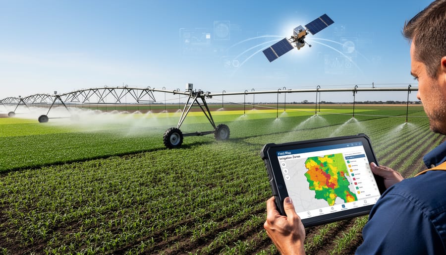
Environmental remote sensing is transforming how Canadian prairie farmers manage their most precious resources: soil and water. Satellite imagery, drone technology, and ground-based sensors now provide detailed information about field conditions that were invisible just a decade ago. These tools detect soil moisture levels across entire fields, identify compacted areas limiting water infiltration, and pinpoint zones where nutrients are leaching beyond root zones.
For Alberta farmers facing increasingly variable precipitation patterns, remote sensing offers a practical solution to age-old challenges. Instead of relying on visual assessment or random soil sampling, you can now access precise data about every hectare of your operation. Multi-spectral imaging reveals crop stress days before it’s visible to the naked eye, allowing targeted irrigation that saves thousands of litres of water while maintaining yield. Thermal sensors identify cold spots indicating poor drainage or warm areas signaling moisture deficiency.
The technology has become remarkably accessible. Many agricultural service providers across the prairies now offer remote sensing analysis at costs comparable to traditional soil testing, with far greater spatial coverage. Recent case studies from central Alberta demonstrate yield increases of 8-12% when farmers use remote sensing data to guide variable-rate irrigation and fertilizer application.
Understanding how these tools work and integrating them into your management decisions doesn’t require an engineering degree. The key is knowing which sensors provide the most relevant information for your specific soil types and crops, then using that data to make timely, targeted interventions that protect both productivity and environmental health.
What Environmental Remote Sensing Really Means for Your Farm
The Technology Behind the Data
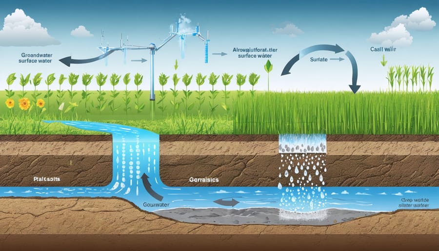
Remote sensing technology might sound complex, but the basic concept is straightforward: specialized sensors measure energy reflected or emitted from the Earth’s surface, giving us valuable information about what’s happening on your fields without setting foot on them.
Think of it like this: just as your eyes detect visible light to see the world around you, remote sensors detect different wavelengths that reveal information invisible to the human eye. Visible light sensors capture what we’d normally see, while infrared sensors detect heat signatures and plant health. Healthy crops reflect infrared light differently than stressed ones, making it easy to spot problem areas before they’re visible to the naked eye.
Thermal sensors measure temperature variations across your fields, helping identify irrigation issues or areas where soil moisture differs. Radar sensors are particularly useful in Alberta’s variable weather because they penetrate cloud cover and work day or night. They’re excellent for monitoring soil moisture levels and tracking changes in ground conditions throughout the growing season.
What does this mean for your operation? These different sensor types work together to provide a complete picture of field conditions. Satellite platforms like Landsat and Sentinel collect data regularly at no cost to you, while drone-mounted sensors offer more detailed, on-demand monitoring. The practical outcome is actionable information about crop health, soil moisture, and field variability that helps you make timely decisions about irrigation, fertilizer application, and harvest planning.
From Satellite Images to Actionable Farm Intelligence
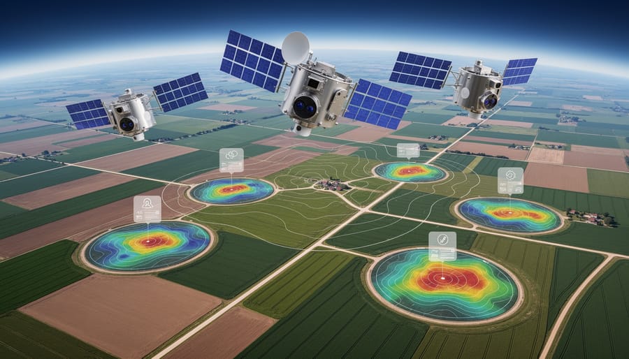
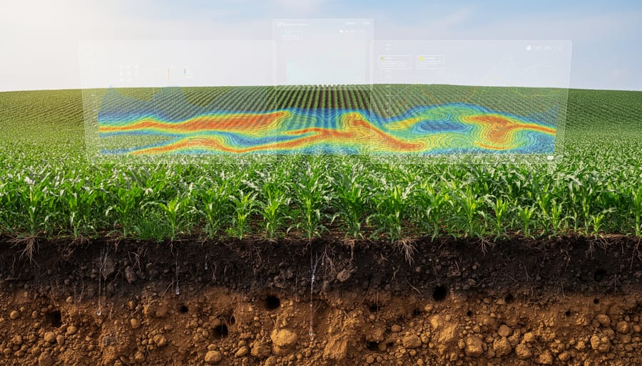
Remote sensing satellites capture images using various wavelengths of light, including infrared bands invisible to the human eye. These raw images undergo sophisticated processing to reveal crucial farm information. Advanced algorithms analyze the spectral signatures reflected from your fields, converting them into practical data about soil moisture distribution, crop water stress, and drainage performance.
For Alberta farmers, this technology translates satellite data into soil moisture maps showing which areas of your field are retaining water and which are draining too quickly. These insights help you identify compaction zones, low-lying areas prone to waterlogging, and spots requiring improved drainage infrastructure. The processed information also generates irrigation prescription maps, indicating precisely where and when water application is needed, potentially reducing water use by 20-30% while maintaining yields.
Many agricultural service providers now offer user-friendly platforms that deliver this processed intelligence directly to your smartphone or computer. Rather than interpreting complex satellite imagery yourself, you receive colour-coded field maps with specific recommendations. For example, red zones might indicate critically dry areas requiring immediate irrigation, while blue zones show adequate moisture levels. This transformation from raw data to actionable insights makes remote sensing accessible to farms of all sizes across the Canadian prairies.
Tracking Soil Moisture Across Your Fields Without Setting Foot Outside
Real-Time Moisture Mapping
Satellite technology now delivers detailed moisture maps covering entire fields, transforming how Alberta producers approach soil moisture management. These systems use multiple satellite platforms to scan your fields every 3-5 days, with some advanced services offering daily updates during critical growing periods.
For typical Alberta farm operations ranging from 400 to 2,000 hectares, current satellite resolution captures moisture variations at 10 to 30-metre intervals across your entire property. This means you can identify dry spots in a quarter section that might be just 50 metres wide, allowing for targeted intervention before crop stress becomes visible.
The technology works by measuring microwave signals that penetrate soil to depths of 5-10 centimetres, providing readings that correlate closely with field measurements. Unlike traditional methods requiring manual soil sampling at multiple points, these moisture maps update automatically and cover every hectare simultaneously.
Manitoba producer James Hendrick explains the practical value: “We receive updated moisture maps twice weekly during seeding and again through harvest. It’s helped us adjust variable rate irrigation on 600 hectares, reducing water use by 18 percent while maintaining yields.”
The spatial detail proves particularly valuable for rolling terrain common across the prairies, where moisture naturally accumulates in low-lying areas while hilltops dry quickly. Cloud cover can delay individual satellite passes, but multi-satellite systems typically maintain consistent coverage even during extended cloudy periods common in spring and fall.
Alberta Case Study: Precision Irrigation in Southern Alberta
When Tom Henderson took over his family’s 800-hectare grain and canola operation near Lethbridge in 2018, water management was his biggest challenge. Like many southern Alberta farmers, he faced increasing pressure from variable precipitation patterns and rising irrigation costs. That’s when he decided to invest in remote sensing technology to guide his irrigation decisions.
Working with a precision agriculture consultant, Tom implemented a system combining satellite imagery with soil moisture sensors across his fields. The normalized difference vegetation index (NDVI) maps revealed significant variability in crop health that wasn’t visible from ground level. Some zones were receiving too much water, while others weren’t getting enough.
The results were compelling. In his first season using remote sensing data, Tom reduced overall water usage by 23 percent while maintaining yields. By the third year, he’d fine-tuned his approach further, cutting water consumption by 31 percent compared to his pre-remote sensing baseline. His canola yields actually improved by 8 percent, thanks to more precise water application that prevented both drought stress and overwatering issues.
Tom’s irrigation scheduling now relies on weekly satellite updates combined with real-time soil sensor readings. He estimates the technology paid for itself within two growing seasons through reduced pumping costs and improved crop performance. Most importantly, he’s protecting his water resources for future generations while maintaining a profitable operation.
Identifying Problem Areas Before They Impact Your Bottom Line
Spotting Water Stress and Nutrient Deficiencies Early
Plants are remarkably good at hiding their struggles until significant damage has occurred. By the time yellowing leaves or wilting becomes visible to the naked eye, yield losses may already be substantial. This is where thermal and multispectral imaging changes the game for water and nutrient management.
Thermal cameras mounted on drones or satellites measure plant canopy temperature. When crops experience water stress, their stomata close to conserve moisture, reducing transpiration and causing leaf temperatures to rise. These temperature differences often appear 3-7 days before any visible wilting occurs, giving you a critical window for irrigation decisions.
Multispectral sensors take this further by capturing light wavelengths beyond what human eyes can see. The near-infrared spectrum is particularly revealing – healthy plants reflect significant near-infrared light, while stressed plants reflect less. This creates vegetation indices that pinpoint areas needing attention.
For nutrient deficiencies, specific spectral signatures emerge early. Nitrogen-deficient plants show distinct patterns in red and near-infrared bands weeks before yellowing appears. An Alberta grain producer using weekly drone flights shared that early detection of nitrogen variability allowed him to apply supplemental fertilizer to specific zones, recovering what would have been a 15% yield loss in those areas.
This proactive approach transforms farm management from reactive firefighting to strategic intervention, protecting both your yields and input investments.
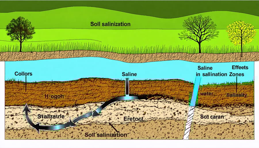
Mapping Soil Salinity and Compaction Issues
Remote sensing technology offers Alberta farmers a powerful tool for identifying problematic soil conditions before they impact crop yields. Satellite and drone-based sensors can detect variations in soil salinity and compaction across your fields by measuring surface reflectance patterns and electrical conductivity signals.
Saline soils, common in many Alberta regions due to natural salt deposits and irrigation practices, show distinct spectral signatures that sensors can identify from above. These areas typically appear lighter in colour and support sparse vegetation growth. By mapping these zones, you can adjust seeding rates, select salt-tolerant crop varieties, or implement targeted drainage solutions. Understanding these soil salinity issues through remote monitoring helps you make informed management decisions.
Compacted soil zones restrict water infiltration and root development, leading to waterlogging or drought stress. Remote sensing detects compaction by identifying areas with poor vegetation vigour and altered moisture patterns. These problem zones often correlate with equipment traffic patterns or naturally dense soil layers.
Alberta farmer James Chen from Lethbridge County used thermal imaging combined with multispectral data to map compaction issues across his 400-hectare operation. “We discovered compacted strips we never knew existed,” he explains. “Targeted deep tillage in those areas improved our water infiltration by 35 percent the following season.”
Optimizing Irrigation Decisions with Satellite Data
Variable-Rate Irrigation: Giving Each Zone What It Needs
Remote sensing technology is revolutionizing how farmers approach precision irrigation by identifying exactly where water is needed most. Instead of applying uniform amounts across entire fields, variable-rate irrigation systems use satellite imagery and sensor data to create detailed irrigation prescription maps. These maps reveal which zones require more water due to sandy soils or drainage issues, and which areas need less because of higher clay content or natural moisture retention.
For Alberta producers, this approach addresses the challenge of managing fields with diverse soil types and varying topography. Remote sensing data captures differences in crop health, soil moisture, and evapotranspiration rates across your operation. Your irrigation system then adjusts water application rates zone by zone, delivering precisely what each area requires.
The benefits extend beyond water conservation. By eliminating overwatering in low-lying areas, you reduce nutrient leaching and disease pressure. Similarly, ensuring adequate moisture in drier zones maximizes yield potential across the entire field. Many Alberta farmers report water savings of 15-30 percent while maintaining or improving crop performance through this targeted approach.
Integration with Existing Irrigation Systems
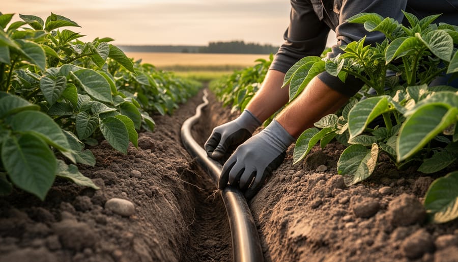
Integrating remote sensing data into your existing irrigation setup doesn’t require a complete overhaul of your current system. Start by identifying compatible entry points where sensor data can enhance your existing infrastructure. Many Alberta farmers have successfully connected remote sensing platforms to their current pivot or drip irrigation controllers through API integrations or manual data inputs.
Begin with a pilot area on your farm, perhaps 20-40 hectares, to test how satellite-derived soil moisture maps align with your current irrigation schedule. This approach minimizes risk while building confidence in the technology. Work with your irrigation equipment dealer to determine if your system supports direct data integration or if you’ll need simple modifications like upgraded controllers.
Most modern irrigation management software can accept CSV files or direct feeds from remote sensing platforms, allowing you to create variable rate irrigation maps. Saskatchewan farmer Tom Richardson found that overlaying NDVI imagery with his existing soil maps helped identify microzones within fields that needed adjusted watering schedules, reducing water use by 18 percent in his first season.
Consider partnering with your local agricultural extension office or irrigation district. Many offer technical support for integrating new data streams into established systems, ensuring you’re making informed adjustments rather than dramatic changes to proven practices.
Managing Water Runoff and Protecting Soil Structure
Erosion Risk Mapping
Remote sensing technology offers prairie farmers a powerful tool for identifying fields at risk of water erosion, particularly during the critical spring snowmelt period when Alberta soils are most vulnerable. By combining high-resolution elevation data with vegetation cover analysis from satellite imagery, farmers can pinpoint areas where water will naturally concentrate and flow during runoff events.
Digital elevation models reveal subtle changes in field topography, showing where water channels form and erosion patterns develop. When overlaid with normalized difference vegetation index (NDVI) data, these maps highlight bare or poorly vegetated slopes where soil lacks protective cover. Fields with exposed ridges, steep grades exceeding 5%, or concentrated flow paths show up clearly as high-risk zones requiring immediate attention.
This mapping approach proved invaluable for several central Alberta grain operations during the 2023 spring thaw. Farmers used erosion risk maps to strategically place straw bales and establish vegetative buffer strips before snowmelt began, reducing soil loss by up to 60% compared to previous years. The technology helps you make informed decisions about field-specific conservation practices, from adjusting tillage patterns to prioritizing cover crop establishment in vulnerable areas. Understanding these erosion hotspots means you can protect both your topsoil investment and downstream water quality.
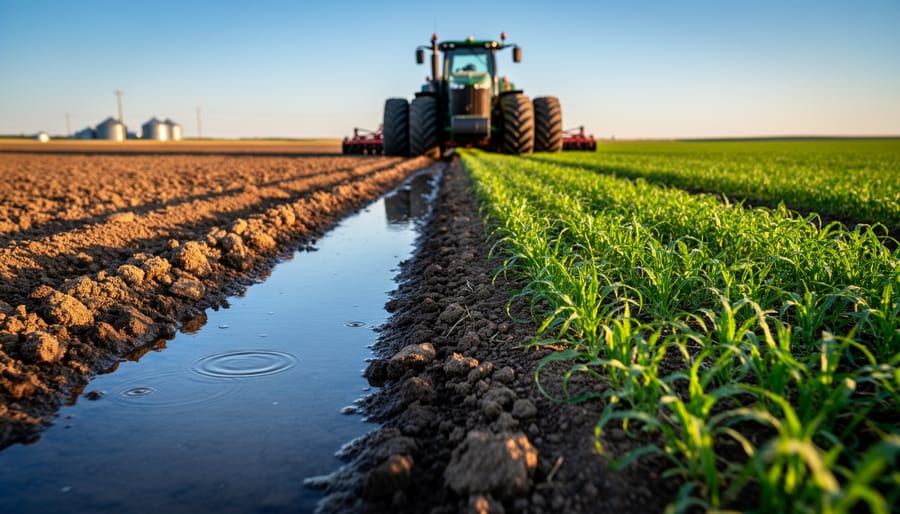
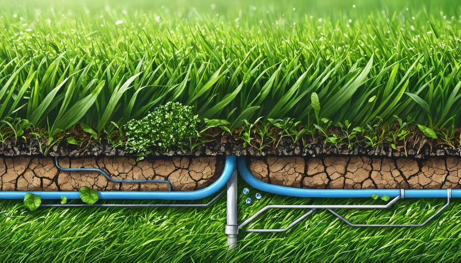
Monitoring Drainage and Runoff Patterns
Remote sensing technology gives you a bird’s-eye view of how water moves across your fields, revealing patterns that are impossible to spot from ground level. Using satellite imagery and aerial sensors, you can identify areas where water pools, track surface runoff paths, and pinpoint spots where water infiltration is compromised.
For Alberta farmers dealing with variable terrain and unpredictable precipitation, this information is invaluable. Remote sensing data helps you map natural drainage corridors and determine optimal locations for tile drainage systems, reducing waterlogging in low-lying areas while preserving soil structure. The technology also identifies where buffer zones and grassed waterways would be most effective at controlling erosion and filtering runoff before it reaches watercourses.
Many prairie farmers have used these insights to redesign their field drainage strategically, improving crop yields in previously problematic areas while protecting water quality. By monitoring seasonal changes in drainage patterns, you can adjust management practices year over year, ensuring your water management system evolves with changing conditions and supports long-term soil health.
Accessible Tools and Platforms for Canadian Farmers
Free and Low-Cost Satellite Data Sources
Canadian farmers have excellent access to free and low-cost satellite data that can transform how you manage soil and water resources. Agriculture and Agri-Food Canada (AAFC) leads several initiatives providing valuable remote sensing tools at no charge. The AAFC Earth Observation team offers free crop inventory data, soil moisture mapping, and land use classification specifically tailored to Canadian growing conditions.
The Canadian Satellite Earth Observation Network provides access to RADARSAT imagery, which is particularly useful for monitoring soil moisture even through cloud cover—a common challenge in prairie agriculture. NASA’s Landsat program and the European Space Agency’s Copernicus Sentinel satellites offer imagery with 10-30 metre resolution, updated every few days, through platforms like EarthExplorer and Sentinel Hub.
For practical application, Google Earth Engine provides free analysis tools that process massive datasets without requiring expensive software or computing power. Alberta farmers have successfully used these platforms to track irrigation efficiency and identify drainage issues before they impact yields. Many provincial agricultural extension services also offer training sessions on accessing and interpreting this data. Start by exploring AAFC’s Annual Crop Inventory, which provides baseline information about your region, then gradually incorporate more specialized datasets as you become comfortable with the technology.
Commercial Platforms Worth Considering
For farms ready to scale up their remote sensing operations, several commercial platforms offer comprehensive features that justify their investment. These services typically bundle satellite imagery, advanced analytics, and dedicated support into packages tailored for different operation sizes.
Farmers Intelligence and Climate FieldView are popular choices among Canadian producers, offering field-level insights starting around $2-4 per acre annually. These platforms excel at integrating multiple data sources, from weather stations to soil moisture sensors, providing unified dashboards that simplify decision-making. Their customer support teams understand prairie agriculture and can help troubleshoot issues during critical growing periods.
For operations managing 500-1,000 acres, the cost-benefit calculation often tips toward commercial platforms. One central Alberta grain producer found that Climate FieldView’s variable rate irrigation recommendations reduced water use by 18 percent while maintaining yields, paying for the subscription within a single season.
Mid-sized operations (1,000-3,000 acres) particularly benefit from features like automated alerts for soil moisture thresholds and seamless integration with existing farm management software. These platforms also offer historical data storage, enabling year-over-year comparisons that inform long-term land management strategies.
Larger operations above 3,000 acres might consider enterprise solutions like Trimble Ag Software or John Deere Operations Center, which offer customizable workflows and multi-user access for farm teams.
Expert Perspective: Making Remote Sensing Work in Alberta Conditions
We spoke with Dr. Sarah Chen, a soil scientist who has spent the past eight years helping Alberta farmers integrate remote sensing into their operations. Her insights offer valuable perspective for producers considering this technology.
“The biggest misconception I hear is that remote sensing won’t work here because of our variable weather,” Dr. Chen explains. “Actually, Alberta’s conditions make it more valuable, not less. When you’re dealing with unpredictable moisture patterns and diverse soil types within a single quarter section, having detailed spatial data becomes critical.”
Dr. Chen emphasizes that success starts with understanding your specific goals. “Don’t buy technology first and figure out the application later. Start by identifying your main challenge—is it variable emergence, nitrogen management, or irrigation scheduling? Then choose the tools that address that specific need.”
According to Dr. Chen, the most common obstacle isn’t the technology itself but data interpretation. “Farmers get overwhelmed when they first see an NDVI map with all its colour variations. I always recommend starting with one field you know really well. Use the remote sensing data to confirm what you already observe on the ground. Once you see how the patterns match your experience, you’ll gain confidence in using it for larger areas.”
She highlights irrigation management as the sweet spot for Alberta producers. “Our short growing season means every irrigation decision matters. Remote sensing helps you see moisture stress before your crop shows visible symptoms, typically three to five days earlier than walking the field.”
For soil salinity, another Alberta-specific challenge, Dr. Chen notes that combining spring satellite imagery with targeted soil sampling creates an efficient management approach. “You can identify problem zones from imagery, then ground-truth with samples. This saves both time and money compared to blanket sampling.”
Her advice for getting started? “Connect with other farmers already using these tools. Alberta has a strong network of early adopters who love sharing their experiences. Learning from their mistakes and successes will shorten your learning curve considerably.”
Getting Started: Your First Steps with Remote Sensing
Starting with remote sensing doesn’t require a complete overhaul of your current operations. Many Alberta farmers have successfully integrated this technology by taking measured, practical steps that build confidence and demonstrate value.
Begin with a pilot project on a portion of your land, ideally an area where you’ve experienced variability in crop performance or water availability. Many service providers offer trial periods or seasonal packages specifically designed for first-time users. This allows you to test the technology without significant upfront investment. Consider starting with 50 to 100 hectares to gain meaningful insights while keeping costs manageable.
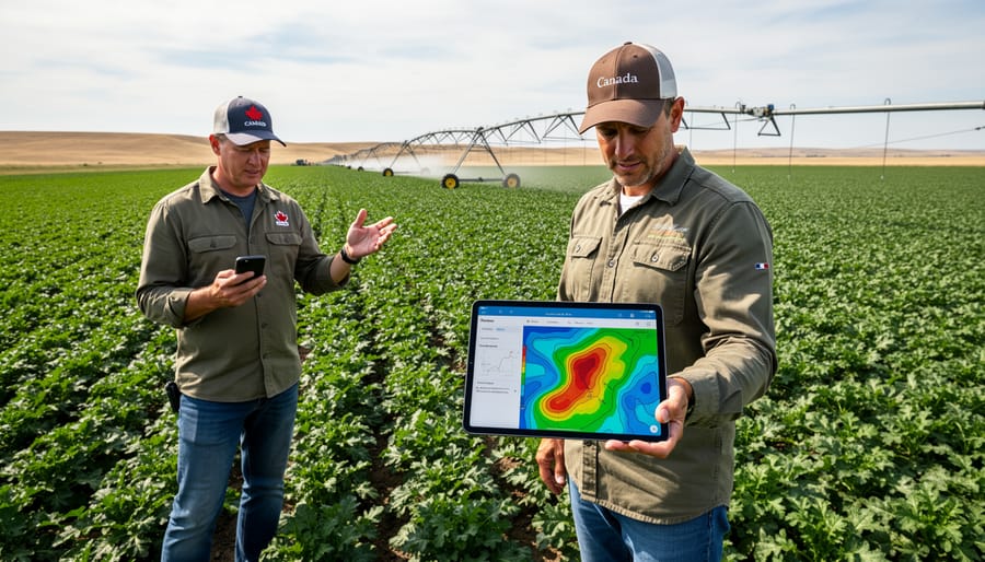
Focus initially on one or two key metrics that align with your current challenges. If water management is your primary concern, satellite imagery showing soil moisture patterns and vegetation stress can directly inform irrigation decisions. These data layers typically use color-coded maps where red zones indicate stress and green zones show healthy growth, making interpretation straightforward even without technical expertise.
Connect remote sensing data with your existing water conservation strategies and field observations. Walk your fields with printed satellite maps in hand, comparing what the sensors detect with what you see on the ground. This ground-truthing builds your understanding and confidence in data interpretation.
Work with agricultural technology advisors or extension specialists who understand Canadian prairie conditions. Many provincial agriculture departments offer workshops on precision farming technologies. Local agronomists can help translate satellite data into specific management recommendations tailored to your soil types and crops.
Keep detailed records comparing remote sensing insights with your field actions and outcomes. Document what worked, what didn’t, and how the technology influenced your decisions. This practical learning foundation will guide your expanded use of remote sensing across larger areas and additional applications over time.
Environmental remote sensing represents a practical pathway forward for Canadian farmers looking to strengthen their soil and water management practices. The technology delivers tangible benefits that directly impact your operation’s bottom line while protecting the land for future generations. By providing precise information about soil moisture levels, water stress in crops, and drainage patterns across your fields, remote sensing helps you make smarter decisions about irrigation timing and fertilizer application. This means less water waste, reduced input costs, and healthier crops that can better withstand our increasingly variable prairie weather.
The beauty of this technology lies in its scalability. You don’t need to adopt everything at once. Start small with one field or a single growing season trial. Many Alberta farmers have found success by beginning with basic satellite imagery services before gradually incorporating more sophisticated monitoring tools as they become comfortable with the data. The investment often pays for itself through improved resource efficiency within the first few years.
Consider connecting with your local agricultural extension office or farmer networks to share experiences and learn from others who’ve already integrated remote sensing into their operations. Knowledge-sharing strengthens our entire agricultural community and accelerates everyone’s learning curve. Whether you farm 160 hectares or 1,600, remote sensing offers practical solutions that support both your farm’s profitability and environmental stewardship goals. The technology is here, accessible, and ready to work for you.