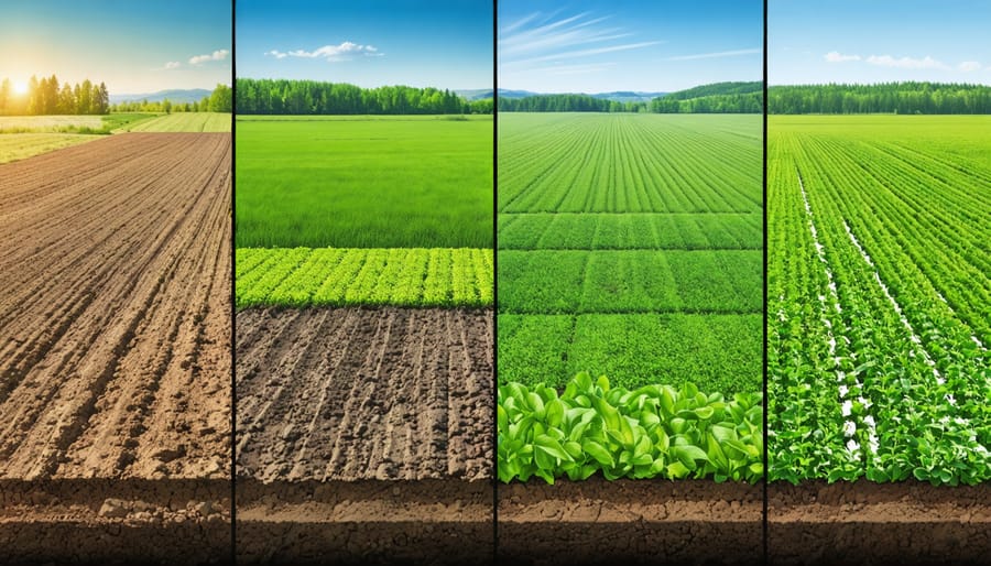
Alberta’s soil conditions vary dramatically across regions, from heavy clay in the Peace Country to sandy loam in the southeast, making one-size-fits-all management approaches ineffective and costly. Precision agriculture tools now give you the power to understand exactly what’s happening in each zone of your fields, helping you apply inputs only where needed and protect soil health for future generations.
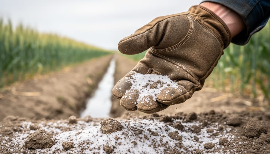
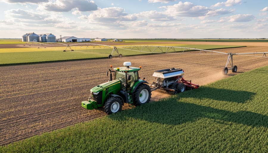
Modern soil management technology has evolved far beyond simple GPS guidance. Variable rate application systems let you adjust fertilizer, seed, and amendments based on real-time soil data, reducing input costs by 15-30% while maintaining or improving yields. Soil sensors and electromagnetic mapping reveal moisture levels, compaction zones, and nutrient variations you can’t see from the tractor cab. Yield monitoring equipment shows you which management decisions are actually working, turning every harvest into a learning opportunity.
The investment question matters, especially for mid-sized operations where every dollar counts. A Lacombe-area grain farmer recently shared how electromagnetic soil mapping identified saline patches consuming inputs without returns, allowing him to redirect those resources to productive areas and recover his technology investment within two growing seasons. Another producer near Lethbridge uses moisture sensors to optimize irrigation timing, cutting water use by 20% while avoiding the yield penalties of stress.
These tools work together as a system, not isolated purchases. Start by identifying your most pressing soil challenge, whether that’s variability, compaction, nutrient imbalances, or moisture management, then select technologies that directly address that specific issue on your operation.
Why Alberta’s Soil Demands a Precision Approach
The True Cost of Guesswork in Soil Management
Managing soil without reliable data costs Canadian farmers more than most realize. A 2022 study across Prairie farms found that guesswork-based fertilizer applications resulted in an average over-application of 15-20% in some field areas, while other zones received 30% less than needed. This translates to roughly $40-60 per acre in wasted inputs annually, not counting the yield losses from under-fertilized areas.
The environmental toll compounds these financial losses. Excess nitrogen from uniform applications leaches into groundwater or converts to greenhouse gases, while phosphorus runoff contributes to algae blooms in nearby waterways. Fields managed without soil data typically show nutrient runoff rates 25-40% higher than precision-managed counterparts.
Consider the experience of a 2,000-acre grain operation near Red Deer, Alberta. Before adopting soil mapping technologies, the farm applied uniform fertilizer rates across all fields, spending approximately $95,000 annually on inputs. Yield maps showed frustrating inconsistencies, ranging from 45 to 75 bushels per acre within single fields.
After implementing precision soil testing and variable rate technology, the operation reduced overall fertilizer costs by $14,000 while increasing average yields by 8 bushels per acre. The farm now applies up to 40% less fertilizer in naturally rich zones and increases rates where soil tests reveal deficiencies. Within two growing seasons, they recovered their technology investment and continue seeing improved soil health metrics across their operation.
What Makes Alberta Soil Different
Alberta’s agricultural landscape spans four distinct soil zones, each presenting unique challenges that precision tools help address. The Dark Brown and Brown soil zones dominate southern Alberta, characterized by lower organic matter (2-4%) and moisture limitations that require careful nutrient management. Moving north, the Black soil zone offers higher organic content (5-8%) but faces different challenges including heavier clay textures and varying drainage patterns. The Gray Wooded soils of the Peace Region contain more acidic conditions and shorter growing seasons.
This diversity explains why blanket fertilizer applications often underperform across the province. A field in Lethbridge responds differently to nitrogen than one near Westlock, even with identical crops. Tom Richardson, a Red Deer-area agronomist with 25 years of experience, notes that “variable rate technology revealed 40% yield differences within single quarter-sections on Black soil farms – areas conventional methods treated uniformly.”
These variations make Alberta ideal for precision agriculture adoption. Soil mapping technologies identify micro-zones within fields, allowing farmers to optimize inputs for each area’s specific characteristics. This targeted approach supports climate-resilient farming while reducing waste and improving profitability across all soil types.
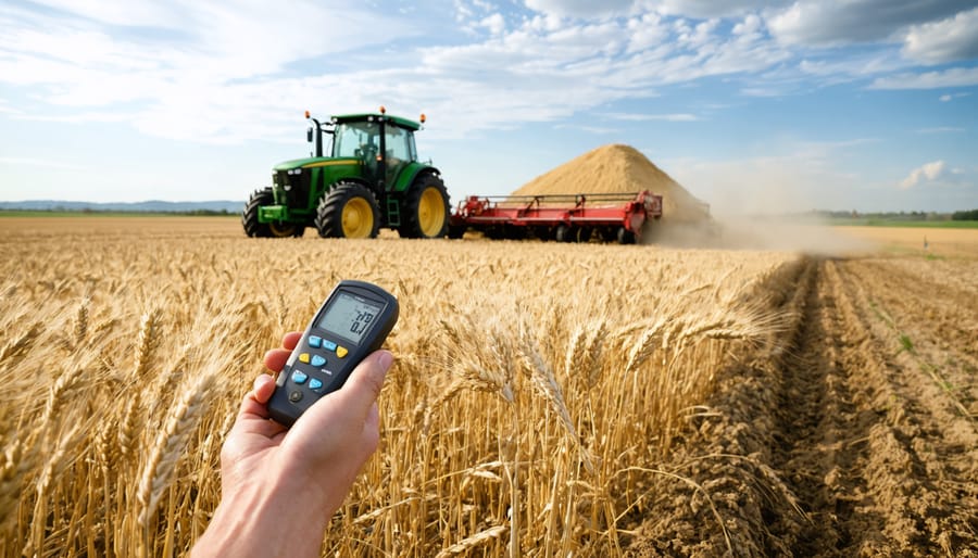
Soil Sensors That Pay for Themselves
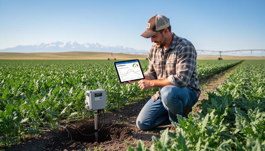
Moisture Monitoring That Actually Works
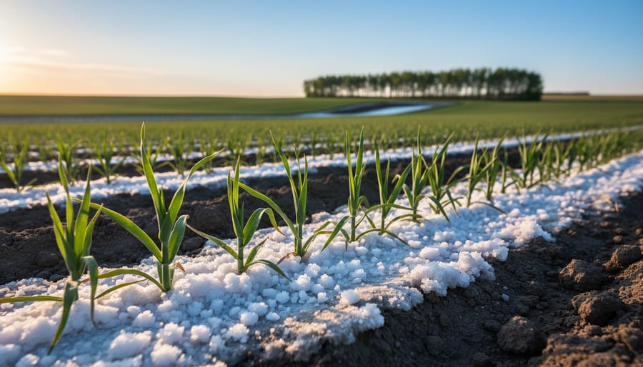
Soil moisture sensors have become game-changers for Alberta farmers dealing with unpredictable rainfall patterns and varying soil types across their operations. Three main sensor types dominate the market: capacitance probes (measuring moisture at multiple depths), tensiometers (measuring soil water tension), and time-domain reflectometry systems (providing highly accurate readings but at a higher price point).
For most Alberta operations, capacitance sensors offer the best balance of accuracy and affordability, typically ranging from $300 to $800 per unit. Installation matters significantly—place sensors in representative zones that reflect your field’s variability, avoiding edges, low spots, or areas with compaction issues. Install at depths matching your primary root zones, typically 15, 30, and 60 centimetres for cereals and canola.
Interpretation becomes straightforward with practice. Most systems display moisture as volumetric water content (percentage) or as deficit from field capacity. When sensors show moisture dropping below 50 percent of available water capacity, irrigation scheduling becomes critical. This data directly impacts water infiltration patterns and root development.
Red Deer area farmer James Kowalski reports saving 25 percent on irrigation costs after installing a six-sensor network across his 160-hectare potato operation. “We were over-watering by habit,” he explains. “The sensors showed our clay-loam held moisture much longer than we thought.”
The technology prevents the costly mistake of irrigating when unnecessary—particularly valuable during Alberta’s variable spring and summer precipitation patterns when visual assessment alone proves unreliable.
Reading Your Soil’s Nutrient Story
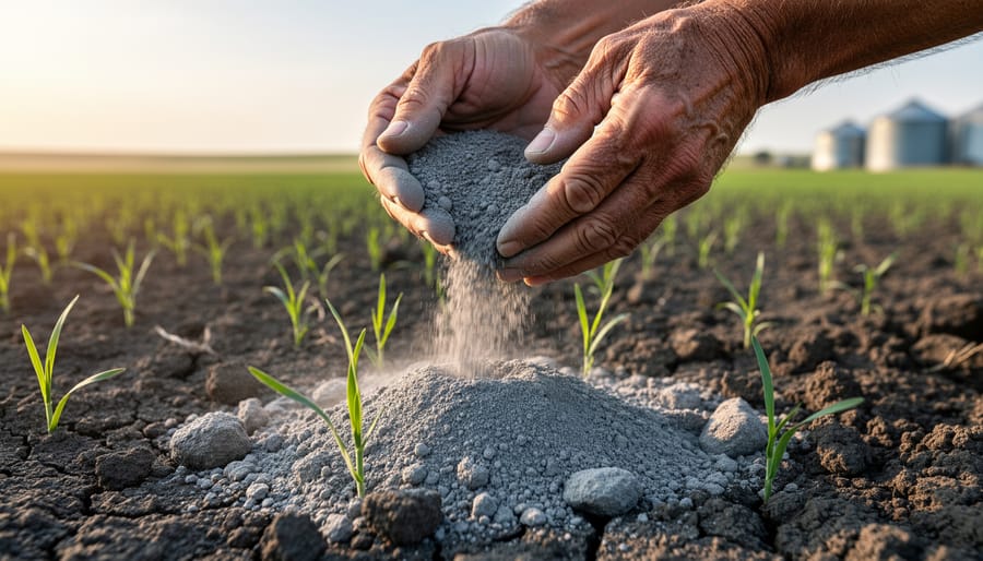
Modern soil nutrient sensors and testing technologies are transforming how Alberta farmers make fertilizer decisions, turning guesswork into data-driven precision. These tools read your soil’s nutrient story in real-time, helping you apply exactly what your crops need, where they need it.
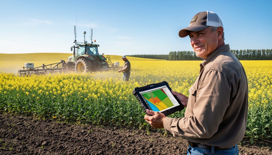
Portable soil nutrient sensors work like mini-laboratories in your field. You can take instant readings of nitrogen, phosphorus, potassium, and pH levels without sending samples to a lab. Grid sampling combined with GPS mapping creates detailed nutrient maps showing variations across your fields. This precision reveals that your 65-hectare field might have six different nutrient zones, each requiring customized fertilizer applications.
Variable rate technology then uses these maps to adjust fertilizer application rates on-the-go. Your spreader automatically increases or decreases output as you move through different zones. The impact? Many Alberta grain farmers report fertilizer savings of 15-25% while maintaining or improving yields.
Jason Mueller, a central Alberta canola producer, shares his experience: “We started grid sampling three years ago and discovered we were over-applying nitrogen in some areas by 30 kilograms per hectare. The nutrient data completely changed our approach.”
These technologies integrate seamlessly with existing nutrient management strategies, helping you apply the right product at the right rate, time, and place. Beyond cost savings, you’re reducing nutrient runoff, protecting water quality, and building healthier soils. The soil’s story becomes your roadmap to sustainable profitability.
Variable Rate Technology: Treating Every Acre Like It Matters
Getting Started Without Breaking the Bank
You don’t need to invest in a complete precision ag system right from the start. Many Alberta farmers are finding success by starting small and building their technology suite over time based on what delivers the clearest return on investment.
Grid soil sampling remains one of the most affordable entry points into variable rate technology. At roughly $8-12 per hectare, it provides the foundation for VRT fertilizer applications without requiring expensive equipment upgrades. Tom Henderson from Lacombe started with basic grid sampling on 400 hectares in 2019 and recovered his investment within two seasons through reduced fertilizer costs alone.
Retrofit solutions offer another budget-friendly pathway. Installing rate controllers on existing spreaders and sprayers typically costs between $5,000-15,000, compared to $50,000+ for new VRT-ready equipment. Companies like Raven Industries and TeeJet Technologies provide systems that integrate with most equipment manufactured in the past 15 years.
For your first investment, prioritize tools that address your biggest pain point. If fertilizer costs are eating into margins, start with VRT nutrient application. Dealing with variable yields across fields? Begin with yield monitoring to identify patterns before investing in solutions.
Greg Sutherland, an agronomist working throughout central Alberta, recommends farmers “start with good data collection before buying application technology. Understanding where your problems exist matters more than having fancy equipment to address them everywhere.” Many equipment dealers now offer seasonal rental programs, letting you test precision tools during critical windows without the full purchase commitment.
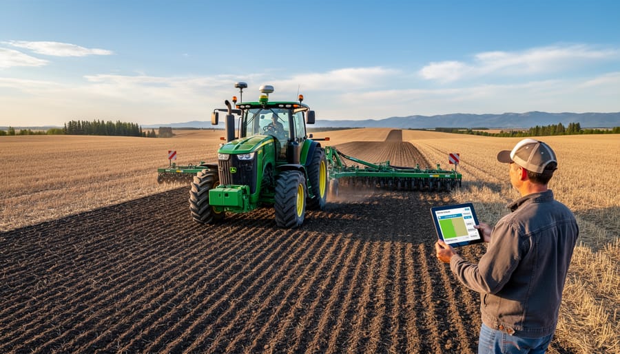
From Data to Action: Making VRT Work on Your Farm
Successfully implementing VRT starts with building your soil data foundation. Begin with a comprehensive soil sampling program, collecting samples on a grid pattern—typically 1 to 2.5-hectare grids work well for most Alberta operations. Consider zone sampling based on topography and historical yield data to make sampling more efficient and targeted.
Once you have soil test results, work with your agronomist to interpret the data and create management zones. These zones group areas with similar characteristics, making prescriptions more practical. Most farms identify 3 to 5 distinct management zones initially—you can always refine these as you gain experience.
The next step is prescription creation. Your agronomist or precision ag dealer will help translate soil data into variable rate application maps for your equipment. Start simple with one or two inputs like fertilizer or lime before expanding to seed rates or multiple nutrients. This approach helps you understand the technology without overwhelming your operation.
Before field application, verify your prescription maps load correctly into your equipment controller. Run a test pass to confirm application rates match your prescription—this simple check prevents costly mistakes. Keep detailed records of what you applied where, linking them back to your soil health fundamentals and yield data.
Common pitfalls include overselling the immediate payback and underestimating the learning curve. Give yourself two to three seasons to see clear patterns emerge, and don’t hesitate to adjust your approach based on what the data reveals.
GPS and Guidance Systems That Save Time and Soil
Reducing Compaction in Alberta’s Heavy Soils
Alberta’s clay-heavy soils are particularly vulnerable to compaction, which can reduce yields by 10 to 50 percent depending on severity. GPS guidance systems offer a practical solution by ensuring equipment follows the same paths consistently, limiting soil disturbance to designated traffic lanes.
“We’ve seen remarkable improvements in soil structure since implementing GPS-guided controlled traffic farming,” says Derek Haugen, who farms 2,000 hectares near Lacombe. “Our clay soils used to get severely compacted after wet spring seeding, but now we’re maintaining better tilth and seeing improved water infiltration.”
By reducing the percentage of field area subjected to wheel traffic from 80 percent down to 15 to 20 percent, GPS guidance preserves soil structure where crops actually grow. This is especially valuable during Alberta’s unpredictable spring conditions when soil moisture levels can make fields vulnerable to compaction damage.
The technology also enables farmers to reduce unnecessary passes across fields. Precise application of inputs means fewer trips over the same ground, and Auto-Steer systems maintain optimal spacing between passes, eliminating overlap that compounds compaction issues in clay soils.
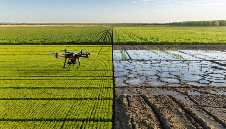
Remote Sensing and Drone Technology for Soil Health Monitoring
What Your Fields Look Like From Above
Imagine having a bird’s eye view of every square metre of your fields, revealing patterns invisible from ground level. That’s exactly what vegetation indices provide to Alberta farmers. The most commonly used index, NDVI (Normalized Difference Vegetation Index), measures how plants reflect light to indicate their health and vigor. Healthy crops absorb red light for photosynthesis while reflecting near-infrared light, creating distinct signatures that satellites and drones can capture.
When you examine NDVI imagery from your fields, darker green zones typically indicate robust crop growth, while yellow or brown areas flag potential problems. These patterns often reveal underlying issues like poor drainage, compaction zones, or nutrient deficiencies that aren’t obvious during field walks. Many Alberta growers have discovered consistent wet spots causing crop stress, or identified areas where fertilizer applications weren’t reaching their full potential.
Beyond NDVI, other indices like NDRE (Normalized Difference Red Edge) can detect nitrogen stress earlier in the growing season, allowing for timely intervention. Manitoba farmer Tom Hendrickson used these tools to identify a phosphorus deficiency pattern that saved him approximately 15% on fertilizer costs by targeting applications more precisely. The real power comes from comparing imagery across multiple growing seasons, building a historical record that helps you understand your soil’s unique characteristics and make data-driven management decisions.
Drone Services Available to Alberta Farmers
Several Alberta companies now offer drone mapping services specifically for agricultural operations, with costs ranging from $8 to $15 per acre depending on flight frequency and data analysis requirements. Providers like Prairie Sky Drones and Alberta Ag Imaging deliver multi-spectral imagery that reveals soil moisture variations, compaction zones, and nutrient deficiencies invisible to the ground observer.
For farmers interested in flying their own drones, Transport Canada certification for basic operations costs approximately $350 and takes about two weeks of online study. Entry-level agricultural drones with multi-spectral cameras start around $5,000, making DIY monitoring viable for operations over 400 hectares.
Jason Timmerman, a grain farmer near Red Deer, switched from contracted services to operating his own drone after two seasons. “The flexibility to fly exactly when conditions demand it paid for the drone in one growing season,” he explains. “I caught emerging fusarium patterns in my wheat that wouldn’t have been visible during a scheduled flyover.”
Aerial monitoring makes most economic sense for fields with known variability issues, high-value crops, or when scouting large acreages becomes time-prohibitive. Most Alberta farmers find weekly flights during critical growth stages provide optimal decision-making data without overwhelming their management capacity.
Real Alberta Farmers, Real Results
When Tom Schneider from Lethbridge County started noticing inconsistent canola yields across his 800-hectare operation in 2019, he knew something had to change. “I was farming the same way my father did, but our soil conditions vary so much from field to field that a one-size-fits-all approach just wasn’t cutting it anymore,” Tom explains.
He invested in a combination of precision ag tools, starting with an electromagnetic soil mapping system and a grid soil sampling service. The initial investment was $8,500, which felt steep at first. “The EM mapping revealed things I never would have guessed,” Tom says. “Areas I thought were uniform actually had three distinct soil zones with different water-holding capacities and nutrient levels.”
The biggest challenge came with interpreting the data and creating variable rate application maps. Tom worked with an agronomist who helped translate the soil information into actionable prescriptions for fertilizer and seeding rates. Within two growing seasons, Tom saw a 12 percent increase in overall yield and reduced his fertilizer costs by $18 per hectare. “The tools paid for themselves faster than I expected, but the real value is knowing exactly what’s happening in every corner of my fields.”
Sarah Chen operates a mixed grain farm near Olds and took a different approach. After attending a precision ag workshop in Red Deer, she started with yield monitoring equipment installed on her combine. “I wanted to see the problem before investing in solutions,” Sarah explains. The yield maps from 2020 and 2021 revealed consistent underperformance in specific zones.
She then added a real-time soil sensor system that mounts on her seeding equipment, measuring organic matter and moisture as she plants. This cost $15,000 but eliminated the need for extensive soil sampling. Sarah faced technical challenges initially, particularly with GPS accuracy during cloudy days, but firmware updates resolved most issues.
Her key lesson? Start small and build your precision system gradually. “I see neighbours buying everything at once and getting overwhelmed. Take time to understand each tool before adding the next one.”
Meanwhile, the Kowalski family farm near Grande Prairie focused on soil compaction issues affecting their wheat and barley production. They invested in penetrometer testing equipment and discovered compaction layers at 20 to 30 centimetres depth in their heavier clay soils. Combined with variable depth tillage based on soil mapping data, they improved water infiltration by 35 percent in problem areas, significantly reducing standing water issues that had plagued them for years.
Making the Investment Work for Your Operation
Canadian Funding and Support Programs
Alberta farmers have several funding options to help offset the costs of adopting precision agriculture tools. The federal government’s Canadian Agricultural Partnership offers cost-share programs through Results-Driven Agriculture Research (RDAR) initiatives, with some programs covering up to 50% of eligible precision technology investments.
At the provincial level, Agriculture Financial Services Corporation (AFSC) provides specialized loan programs for equipment purchases, including variable rate technology and soil sensors. The Environmental Stewardship and Climate Change (ESCC) program specifically supports farmers implementing precision tools that reduce environmental impact and improve soil health.
Many Alberta municipalities also offer grants for sustainable farming practices. For example, the county-level Growing Forward programs have helped producers purchase GPS-guided equipment and grid sampling services. These investments often qualify for additional benefits through carbon credit opportunities when precision tools demonstrate measurable environmental improvements.
Local agricultural fieldmen and extension services provide free technical assistance to help navigate application processes. The Alberta Agriculture and Irrigation regional offices offer one-on-one consultations to assess which precision tools best suit your operation and which funding streams apply to your specific circumstances.
Common Questions Alberta Farmers Ask About Precision Ag Tools
Alberta farmers considering precision ag tools often have similar questions. Here’s what you need to know based on conversations with producers across the province.
Can I use precision tools with my existing equipment? Most modern precision tools integrate with equipment from major manufacturers. Many systems offer universal monitors and retrofit options for older machinery. Jim Kowalski, a grain farmer near Lethbridge, successfully added variable rate capabilities to his 15-year-old sprayer using aftermarket controllers. Check compatibility before purchasing, and ask dealers about adapter options for your specific equipment brands.
How do I manage all the data these tools generate? Start simple. Many farmers begin by focusing on one or two data layers, like yield maps and soil tests. Cloud-based platforms now handle storage automatically, and most systems include basic analysis tools. You don’t need to be a data scientist. Sarah Chen from Lacombe says she spends about 30 minutes weekly reviewing her field data during growing season, which she finds manageable alongside regular farm tasks.
What’s the learning curve like? Most Alberta farmers report feeling comfortable with basic functions within one growing season. Manufacturers offer training sessions, often held regionally in winter months. Local agronomists can help interpret results initially. The key is starting with one technology rather than implementing everything simultaneously.
Are precision tools only for large operations? Not anymore. Several Alberta farmers operating 400 to 800 hectares report positive returns from variable rate fertilizer application and soil mapping. Equipment-sharing cooperatives and custom applicators offering precision services make these tools accessible without full ownership costs. Smaller operations often see faster payback periods on targeted applications since they can focus intensively on known problem areas.
What are the ongoing costs? Expect annual software subscription fees ranging from $500 to $2,000, depending on features. Data storage is typically included. Some systems require occasional hardware updates, but most equipment lasts 7-10 years with proper maintenance.
Precision agriculture isn’t just for large-scale operations or farms with unlimited budgets. These tools represent an accessible, practical pathway to building healthier soil while strengthening your bottom line. Whether you’re managing 400 hectares near Lethbridge or a mixed operation in the Peace Country, precision ag technology can be scaled to fit your operation’s size and goals.
The key is starting small. You don’t need to invest in every technology at once. Begin with one tool that addresses your most pressing soil management challenge—maybe that’s variable rate fertilizer application to reduce input costs, or soil moisture sensors to improve irrigation timing. As you gain confidence and see results, you can gradually expand your precision ag toolkit.
Connect with your local agronomist, attend field days hosted by organizations like the Alberta Soil Health Coalition, and talk with neighbouring farmers who’ve already adopted these technologies. The Canadian agricultural community is remarkably generous with knowledge sharing, and learning from others’ experiences can help you avoid costly mistakes and accelerate your success.
Remember that precision ag tools are an investment in your farm’s future. The data you collect today builds a foundation for better decisions tomorrow. Every soil sample, yield map, and sensor reading contributes to understanding your land more deeply. This knowledge translates directly into improved soil health, reduced environmental impact, and stronger farm profitability for years to come.
Your soil is your most valuable asset. Precision agriculture gives you the tools to protect and enhance it, one informed decision at a time.